Wiki
Clone wikilumass / Home
![]()
LUMASS - Land-Use Management Support System
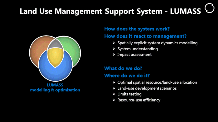
LUMASS is designed to provide support for two high level aspects of land management: i) land use impact assessment and ii) spatial planning. The former aspect is supported by its spatial system dynamics modelling framework and the latter by its spatial optimisation framework.
LUMASS is mainly focused on processing and displaying raster data. However, it also provides selected functionality of displaying (polygon) vector data and 3D point clouds. Spatial optimisation scenarios can also be run on polygon vector layers. Download the LUMASS User Guide and find out more yourself!
Features and Architecture
For an overview of LUMASS' features and its architecture, watch our presentation at FOSS4G 2017 or have a look here. If you're keen to find out a little bit more about how LUMASS looks like under the hood, you may want to read this paper.
Projects
An overview of recent projects where LUMASS played a key role.
References
Links and references to LUMASS related papers, reports, and presentations.
Conferences
Selected conference and workshop material.
Downloads
*LUMASS 0.9.59 for Windows (64 bit)
*Sample data v0.4 for User Guide
OptimisationHowTo v1.2 - Replicate the scenarios and results discussed in "Assessing Resource-Use Efficiency of Land Use" (Herzig et al. 2018)!
Support
User Group: https://groups.google.com/forum/#!forum/lumass-users
Source Code
$ git clone https://landcareresearch@bitbucket.org/landcareresearch/lumass.git
Updated